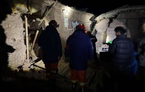
NewDelhi: A 7.0-magnitude earthquake struck Tibet on Thursday evening (October 22). Tremors were felt across several areas. The National Centre for Seismology (NCS) said the earthquake originated 173 km below the earth’s surface. People in several areas came out of their homes and buildings after feeling the tremors.
No official reports of casualties or major damage to property have emerged so far. Authorities are expected to assess the situation as more information becomes available.
The earthquake comes weeks after an August 26 avalanche and floods along the Nepal-Tibet border that left thousands dead or missing and damaged homes, roads, bridges and hydropower projects. Rescue and rehabilitation work is still under way in the affected areas.
The earthquake’s magnitude and depth put it among the stronger seismic events recorded in the region in recent months. Its depth of 173 km means it originated well below the earth’s crust’s shallow layers. Earthquakes at such depths can cause tremors across large areas, allowing people to feel the shaking far from the epicentre.
How Tibet’s earthquakes affect downstream rivers
The Tibetan Plateau is one of Asia’s major sources of freshwater. Several important rivers originate in or flow through the region, including the Yarlung Tsangpo, which enters India as the Brahmaputra before continuing towards Bangladesh.
Changes in the region’s geological and environmental conditions can have implications for communities living downstream, particularly where rivers pass through steep valleys and areas vulnerable to landslides and flooding. The effects of an earthquake depend on its location, depth, magnitude and the surrounding terrain.
The region’s importance to Asia’s river systems also makes information about natural disasters there relevant to countries beyond Tibet.
Tibet also experienced an earthquake on September 3, when the NCS recorded a magnitude 5.0 tremor at around 1.46 pm.
The earthquake’s epicentre was located at 31.479 degrees north latitude and 80.370 degrees east longitude. Its depth was estimated at approximately 14 km below the earth’s surface.
The September earthquake originated much closer to the surface than Thursday’s tremor. Seismic activity in the region continues to be monitored because of its location in a geologically active part of Asia.
Bureau Report
Leave a Reply