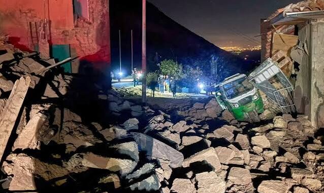
USGS data put the epicenter about 38 kilometers northwest of Upahuacho, a town in the Parinacochas province of the Ayacucho region of Peru. Civic authorities immediately launched a series of field surveys in the southern provinces, including Ica and Arequipa. Local Civil Defence director Luis Vasquez announced through local radio stations that no structural collapse nor any loss of lives was found by emergency teams.
Tsunami not possible: The Directorate of Hydrography and Navigation of the Peruvian Navy officially stated that the seismic event does not carry a tsunami threat for the Pacific coast.
Capital city not hit: Yoni Reyes, the mayor of Parinacochas province, confirmed that all services in the capital of the province are running normally with no interruptions.
Deep focus of the quake: Originating at a depth of 66.7 kilometers, the deep focus of the earthquake has made the tremors travel a greater distance rather than concentrating forces in the epicenter area.
Why does Peru suffer from earthquakes so often?
Peru is situated right at the heart of the “Ring of Fire” – a high seismic zone where tectonic plates meet regularly.
The Nazca Plate subducts under the South American Plate off Peru’s coast, causing earthquakes throughout the mountainous region of Peru.
Comparison with the 2007 Pisco earthquake: In August 2007, there was a massive 8.0 magnitude earthquake near Ica which claimed 519 lives and injured more than 1,000 people in Pisco, Chincha Alta, and Ica.
Lower threat level: This earthquake was much less threatening compared to 2007, thanks to its greater depth which kept the immediate effects minimal.
The civil defense group keeps a continuous watch over the high-altitude rural villages in search of rockslide or after-shocks.
Bureau Report
Leave a Reply